
Autodesk presents Salzburg as the first pilot city of the "Digital Cities" project
The city will collaborate with Autodesk and the Geoinformatics Center of Salzburg University on the development of digital models of the city, which will help better understand the impacts of urban planning and design.
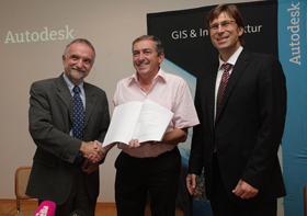 |
| Prof. Josef Strobl, Z_GIS; Dr. Heinz Schaden, mayor of Salzburg; Roland Zelles, Autodesk |
The Digital City project represents Autodesk's unique technology that provides a unified environment for collaboration on visualization, analysis, and simulation of future urban planning and development impacts. Autodesk chose Salzburg for this collaboration, one of Europe’s major cultural and historical centers, to help integrate all city data into a highly detailed 3D model. The combination of city data with realistic visualization and simulation tools will help Salzburg designers visualize and interactively influence the urban landscape, analyzing the impacts of urban planning, tourism, and economic development projects before they begin.
“I am very pleased to announce the launch of a pilot project that is of great significance for modern urban governance. At Autodesk, which is a leader in software innovations for designers, and at Salzburg University, which draws on its many years of experience in geoinformatics, we have two internationally recognized partners joining forces to implement this project. The digital model will help cities like ours better understand the impact of proposed urban projects,” said Dr. Heinz Schaden, the mayor of Salzburg. “This type of pilot program will help us better understand how we can create an attractive and sustainable future for Salzburg and its residents.”
The implementation of the Digital City project for Salzburg involves scientific staff from the Center for Geoinformatics (Z_GIS) at Salzburg University. “As a competence center for geoinformatics, we are pleased to be part of one of the most ambitious projects of its kind in the world, not to mention that we are able to implement it right in our hometown. Thanks to this project, students can gain valuable knowledge and cooperating companies in Salzburg can develop their own services on a new platform. Z_GIS will be strongly focused on economic, scientific, and administrative interfaces.”
“Salzburg is known as a progressive city, making it a natural choice as the first pilot city. Our Digital City technology will help the city and its citizens communicate better, collaborate, and deliver projects significantly more efficiently and sensibly in the long term,” said Lisa Campbell, Vice President of Autodesk Geospatial. “We are proud to partner with Salzburg and our long-time partner, Salzburg University, to create a tool that will help Salzburg plan and implement sustainable development, which is essential for the future of significant cities and economies.”
About Digital City technology
Digital City technology allows actors from the public, municipal government, builders, and entrepreneurs to collaborate and understand the impact of various proposals on the urban environment. It enables credible modeling of the future appearance of the city before its implementation. The goal of this pilot program is for Salzburg to connect 3D models of above-ground and underground elements on an open platform that supports secure and robust integration of CAD data, BIM (Business Information Modeling) methods, geospatial data, engineering networks, and infrastructural data over vast geographic areas. By combining this data with tools for realistic visualization, analysis, and simulation, Digital City technology provides an intuitive and compelling way to understand the impact of plans and proposals at any moment and from any perspective. More information about the Digital Cities project can be found on the website www.autodesk.com/digitalcities.
About Z_GIS center
The Center for Geoinformatics is the largest scientific institute engaged in geoinformatics in Austria. It was established as a competence center at Salzburg University. The main areas of Z_GIS activities are research and development, expanding international relations, organizing symposiums, professional training, and courses. The main task of the center is to provide geoinformation support for a wide range of applications in close cooperation with business and public entities. The work of the Z_GIS team far exceeds the boundaries of university activities and significantly helps present Salzburg University as a competitive institution and create synergistic effects that strengthen the city's position as a center for science and research. More information is available at www.uni-salzburg.at.
About Autodesk
Autodesk is the world leader in 2D and 3D design software for manufacturing, construction, media, and entertainment. Since the introduction of the AutoCAD application in 1982, Autodesk has developed the broadest portfolio of cutting-edge digital prototyping solutions that help customers test ideas practically before implementation. Fortune 1000 companies use Autodesk tools to visualize, simulate, and analyze the real-world functioning of their designs in the early stages of development, helping them save time and money, improve quality, and promote innovation. More information about Autodesk can be found on the websites www.autodesk.com or www.autodesk.cz.
> Autodesk's page in the catalog
The English translation is powered by AI tool. Switch to Czech to view the original text source.